Geosat-2
Mission and sensor parameters
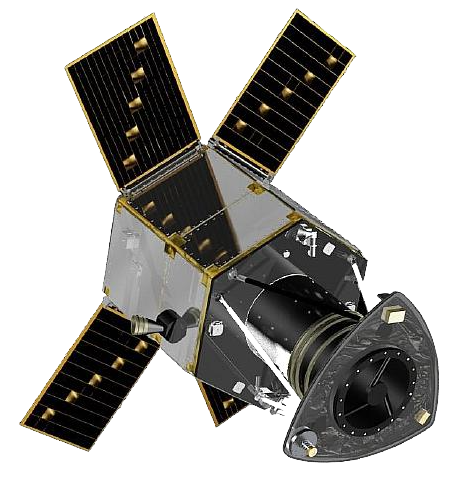
Geosat-2 is a very-high resolution multispectral optical satellite providing 0.75m optical images in the panchromatic band and 4m in the multispectral bands (NIR, RGB), with a 12km swath width at nadir. Launched in June 2014, the Geosat-2 satellite (formerly known as Deimos-2) is currently owned and operated by GEOSAT. Deimos-2 is a continuation of the Deimos-1 mission by the Spanish company Elecnor. In 2021, the company GEOSAT acquired Deimos-1 and 2, and renamed them to Geosat-1 and 2, respectively. The Deimos-2 spacecraft is identical to the DubaiSat-1 minisatellite (launched on 21 November, 2013).
Mission parameters
Table 1 provides a summary of the Geosat-2 mission.
| Parameter | Specifications |
|---|---|
| EO Mission | Geosat-2 |
| Mission Short name | DE2 |
| Providing Agency | GeoSAT Satelites SLU (prev. Elecnor Deimos) |
| Date of launch | 19/06/2014 |
| Temporal coverage | 2014 - present |
| Mission status | onGoing |
| Mission lifetime | >7 years |
| Orbit Type | Sun-synchronous |
| Equator crossing Time | 10:30 AM descending node |
| Orbit Height | 600 km |
| Orbit Period | 96.5 min |
| Inclination | 97.6° |
| Nominal Swath Width | 12 km at nadir (24 km in wide area mode) |
| Revisit | 2 days (worldwide) |
Table 1 - Geosat-2 mission parameters.
Sensor specifications
Geosat-2 is equipped with the High Resolution Advanced Imaging System (HiRAIS) which is a pushbroom type imager. With a swath width of 12 km at nadir Geosat-2 provides satellite imagery at 1 m resolution for panchromatic and at 4 m resolution for multispectral bands (RGB, NIR). Geosat-2 standard pan-sharpened ortho product features a 0.75m resolution, but up to 0.40m resolution could be provided with the support of AI techniques in Geosat-2 super-resolution ortho product. Below table provides spectral mode and spectral combination of the Geosat-2 HiRAIS data. Table 2 reports the HiRAIS instrument technical specifications
| Parameter | Specifications |
|---|---|
| Instrument name | HiRAIS (High Resolution Advanced Imaging System) |
| Imager Type | Scanning technique Pushbroom type imager |
| Imaging Mode | PAN and MS (VIS, NIR) |
| Resolution | Very High Resolution - O-VHR (0 - 1m) |
| Ground Sampling Distance (m) at nadir | 0.7 m (panchromatic), 4 m (multispectral) |
| Nominal Swath Width at nadir | 12 Km |
| Dynamic Range | 10 bit |
| Data products | Standard Ortho at 0.7m, Enhanced Ortho at 0.4m (with AI) |
Table 2 - Geosat-2 instrument technical specifications.
Wavelength, Center wavelength, Bandwidth (or FWHM), and common band name (CBN) for each spectral band of the Geosat-2 sensor are described in table 3.
| Spectral Band (ID) | Wavelength (nm) | Center Wavelength (µm) | Bandwidth or FWHM (µm) | CBN |
|---|---|---|---|---|
| PAN | 560-900 | 0.730 | 0.34 | pan |
| BLUE (B4) | 466-525 | 0.496 | 0.06 | blue |
| GREEN (B3) | 532-599 | 0.566 | 0.07 | green |
| RED (B2) | 640-697 | 0.669 | 0.06 | red |
| NIR (B1) | 770-892 | 0.831 | 0.12 | nir |
Table 3 - Geosat-2 spectral bands.
Geometric and radiometric processing
Processsing levels
Processing levels of Geosat-2 are:
-
L1B (OrthoReady) - Calibrated and radiometrically corrected scaled ToA radiance, not resampled,
-
L1C (Ortho) - Calibrated and radiometrically corrected scaled ToA radiance, orthorectified and resampled,
-
L1S (Enhanced OrthoReady) - Calibrated and radiometrically corrected scaled ToA radiance, not resampled. Enhanced GSD from AI-based techniques,
-
L1D (Enhanced Ortho) - Calibrated and radiometrically corrected scaled ToA radiance, orthorectified and resampled. Enhanced GSD from AI-based techniques.
All Geosat-2 products are orthorectified.
Spectral modes
A mapping of spectral processing and spectral mode is shown in the below table.
| Spectral processing | Spectral mode |
|---|---|
| PAN | PAN |
| MS4, PSH, PS3, PS4 | MS |
| PM4 | PAN, MS |
Table 4 - Geosat-2 spectral modes.
Product description
Standard products options
Geosat-2 product includes panchromatic and/or multispectral data, delivered by the production center differently according to the product. A 3-digit abbreviation identifies the spectral processing of the Geosat-2 product. Options are:
-
PAN - panchromatic,
-
MS4 - multispectral 4-band (B,G,R,NIR),
-
PM4 - bundle contains a PAN and a MS4 product,
-
PSH - pansharpened multispectral 4-band (B,G,R,NIR),
-
PS3 - pansharpened true color 3-band (R,G,B),
-
PS4 - pansharpened false color 3-band (NIR,R,G).
Imagery and metadata formats
The Geosat-2 metadata file is given in DIMAP format v1.1 using a GEOSAT profile.
GeoTIFF is the file format of the full resolution image product provided as a short unsigned 16-bit raster. Geosat-2 imagery is provided either as single-band (e.g. PAN) or multiband raster (e.g. MS4).
Data filename
Product ID for a Geosat-2 product is comprised of:
<NAME_ABBREVIATION><SAT_NUMBER>_<SPECTRAL_PROCESSING>_<PROCESSING_LEVEL>_000000_<IMAGING_START_TIME>_<IMAGING_STOP_TIME>_<NAME_ABBREVIATION><SAT_NUMBER>_<ABSOLUTE_ORBIT>_<NUM_PRODUCT>
where:
-
<NAME_ABBREVIATION>: DE -
<SAT_NUMBER>: 2 -
<SPECTRAL_PROCESSING>: PAN, MS4, PM4, PSH, PS3, PS4 -
<PROCESS_LEVEL>: L1B, L1C, L1S, or L1D -
<IMAGING_START_TIME>: YYYYMMDDTHHMMSS (e.g. 20231025T021856) -
<IMAGING_STOP_TIME>: YYYYMMDDTHHMMSS (e.g. 20231025T021859) -
<ABSOLUTE_ORBIT>: NNNNN E.g. 59890, -
<NUM_PRODUCT>: XXXX E.g. F278.
Ingested format
Information extracted from product annotation included in the STAC item of a Geosat-2 L1C PSH Dataset are listed below.
Properties
STAC item content about properties for a Geosat-2 L1C PSH Dataset is the following:
  "properties": {
    "datetime": "2023-10-25T02:18:56Z",
    "start_datetime": "2023-10-25T02:18:56Z",
    "end_datetime": "2023-10-25T02:18:59Z",
    "created": "2025-10-07T13:33:13.1362284Z",
    "updated": "2025-10-09T08:39:55.0752392Z",
    "agency": "GeoSAT Satelites SLU",
    "platform": "geosat-2",
    "constellation": "geosat",
    "mission": "geosat-2",
    "instruments": [
      "hirais"
    ],
    "spectral_processing": "PSH",
    "sensor_type": "optical",
    "gsd": 0.75,
    "title": "GEOSAT-2 HiRAIS L1C PSH 2023-10-25 02:18:56",
    "metadata_format": "DIMAP",
    "data_file_format": "GEOTIFF",
    "data_file_bands": 4,
    "providers": [
      {
        "name": "GeoSAT Satelites SLU",
        "description": "GEOSAT 2 is a very-high resolution (up to 40cm) multispectral optical satellite with 5 spectral channels, designed for fast off-nadir imaging",
        "roles": [
          "producer",
          "processor",
          "licensor"
        ],
        "url": "https://geosat.space/"
      },
      {
        "name": "GEOSAT",
        "roles": [
          "licensor"
        ]
      }
    ],
    "license": "proprietary",
    "disaster:call_ids": [
      777
    ],
    "disaster:resolution_class": "VHR",
    "cpe:cos2_id": "777-GEOSAT-GEOSAT-2-DE2_PSH_L1C_000000_20231025T021856_20231025T021859_DE2_50668_5E8E"
  }
Satellite
STAC item content about Satellite for a Geosat-2 L1C PSH Dataset is the following:
  "properties": {
    "sat:orbit_state": "ascending",
    "sat:platform_international_designator": "2014-033D"
}
View
STAC item content about View for a Geosat-2 L1C PSH Dataset is the following:
  "properties": {
    "view:azimuth": 349.1,
    "view:sun_azimuth": 119.68521363,
    "view:sun_elevation": 65.6452,
    "view:incidence_angle": 12.1048223037703
}
Processing
STAC item content about Processing for a Geosat-2 L1C PSH Dataset is the following:
  "properties": {
    "processing:level": "L1C"
  }
Projection
STAC item content about Projection for a Geosat-2 L1C PSH Dataset is the following:
  "properties": {
    "proj:epsg": 32750,
    "proj:shape": [20544, 21792]
  }
Geometry
STAC item content about Geometry for a Geosat-2 L1C PSH Dataset is the following:
  "geometry": {
    "type": "Polygon",
    "coordinates": [
      [
        [119.768744, -0.155859],
        [119.793884, -0.280338],
        [119.906736, -0.25769],
        [119.881596, -0.133211],
        [119.768744, -0.155859]
      ]
    ]
  },
  "bbox": [119.768744, -0.280338, 119.906736, -0.133211]
Assets
STAC item content about assets (annotation, quicklooks and spectral bands files harvested from the source product) and EO bands for a Geosat-2 L1C PSH Dataset is the following:
  "assets": {
    "MS-L1C-PSH": {
      "type": "image/tiff; application=geotiff",
      "roles": [
        "data",
        "dn"
      ],
      "title": "MS L1C PSH Ortho",
      "href": "https://.../datasets/DE2_PSH_L1C_000000_20231025T021856_20231025T021859_DE2_50668_5E8E/MS-L1C-PSH.tif",
      "filename": "DE2_PSH_L1C_000000_20231025T021856_20231025T021859_DE2_50668_5E8E.tif",
      "file:size": 3581908423,
      "eo:bands": [
        {
          "name": "BAND-1 NIR in W*m^-2*µm^-1*str^-1",
          "description": "NIR Ortho PSH in W*m^-2*µm^-1*str^-1",
          "common_name": "nir",
          "center_wavelength": 0.831,
          "full_width_half_max": 0.12,
          "solar_illumination": 1076.885158
        },
        {
          "name": "BAND-2 RED in W*m^-2*µm^-1*str^-1",
          "description": "Red Ortho PSH in W*m^-2*µm^-1*str^-1",
          "common_name": "red",
          "center_wavelength": 0.669,
          "full_width_half_max": 0.06,
          "solar_illumination": 1517.427492
        },
        {
          "name": "BAND-3 GREEN in W*m^-2*µm^-1*str^-1",
          "description": "Green Ortho PSH in W*m^-2*µm^-1*str^-1",
          "common_name": "green",
          "center_wavelength": 0.566,
          "full_width_half_max": 0.07,
          "solar_illumination": 1794.381858
        },
        {
          "name": "BAND-4 BLUE in W*m^-2*µm^-1*str^-1",
          "description": "Blue Ortho PSH in W*m^-2*µm^-1*str^-1",
          "common_name": "blue",
          "center_wavelength": 0.496,
          "full_width_half_max": 0.06,
          "solar_illumination": 1811.593874
        }
      ],
      "raster:bands": [
        {
          "data_type": "uint16",
          "bits_per_sample": 16,
          "scale": 0.006800104616,
          "offset": -0.00680010461
        },
        {
          "data_type": "uint16",
          "bits_per_sample": 16,
          "scale": 0.011123248049,
          "offset": -0.01112324804
        },
        {
          "data_type": "uint16",
          "bits_per_sample": 16,
          "scale": 0.013184818227,
          "offset": -0.01318481822
        },
        {
          "data_type": "uint16",
          "bits_per_sample": 16,
          "scale": 0.014307912429,
          "offset": -0.01430791242
        }
      ]
    },
    "metadata": {
      "type": "application/xml",
      "roles": [
        "metadata"
      ],
      "title": "Metadata file",
      "href": "https://.../datasets/DE2_PSH_L1C_000000_20231025T021856_20231025T021859_DE2_50668_5E8E/metadata.dim",
      "filename": "DE2_PSH_L1C_000000_20231025T021856_20231025T021859_DE2_50668_5E8E.dim",
      "file:size": 9928
    }
  }
Product Calibration
For Geosat-2 products calibration refer to the Optical Products Calibration (OPT-Calib) service and the calibration sheet available here.
[2]: ESA, Earth Online, GEOSAT-2, Available at: https://earth.esa.int
[3]: EO Portal, Deimos-2/Geosat-2. Available at: www.eoportal.org
-
GeoSAT, Geosat-2 User Manual. Available at: geosat.space ↩